Martes, Enero 6, 2015

Beauty Of Palawan 

Palawan (Tagalog pronunciation: [pɐˈlawan]), officially the Province of Palawan (Filipino: Lalawigan ng Palawan), is an island province of thePhilippines that is located in the MIMAROPA region. It is the largest province in the country in terms of total area of jurisdiction. Its capital is Puerto Princesa City, but it is governed independently from the province.
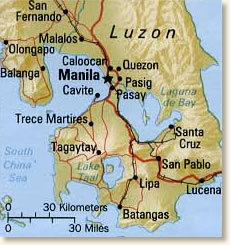
The islands of Palawan stretch from Mindoro in the northeast to Borneo in the southwest. It lies between the South China Sea and the Sulu Sea. The province is named after its largest island, Palawan Island(09°30′N 118°30′E), measuring 450 kilometres (280 mi) long, and 50 kilometres (31 mi) wide.[5][6]
Puerto Princesa’s pride is easily the Puerto Princesa Subterranean River (or Underground River), a UNESCO World Heritage Site and one of the New 7 Wonders of Nature.
The 8.2-kilometer river, said to be the longest navigable underground river in the world, winds its way underneath a mountain range, through the St. Paul Underground River Cave, and then goes out into the South China Sea. The journey through the cave system alone is 24 kilometers long.
The entire area where the Underground River is located is actually a national park and a model of biodiversity. More than 800 plant species, including almost 300 trees, 195 bird species, 30 mammals, 19 reptiles, and eight bat species call this area home.
Looking to swim? Island hopping is one of the biggest draws of Puerto Princesa. At Honda Bay, boats take tourists to nearby islands for lunch picnics, snorkeling and non-stop swimming. The calm water and sandy bottoms beat any hotel pool.
Puerto Princesa is also home to more secluded and less commercial beaches. Try the beaches of Nagtabon, Napsan, and Marufinas if you want to enjoy fine beaches and awesome sunsets away from the crowds.
In the municipality of Narra, Arena Island, a turtle sanctuary, and Rasa Island, a bird sanctuary, both have island-hopping opportunities.
A three-hour ride also takes you to Port Barton in the municipality of San Vicente, which has been described as a backpacker’s dream. The only problem you might have is deciding whether to swim, dive, snorkel or just swing to sleep on a hammock.
Get a glimpse of Puerto Princesa’s heritage in the Batak Cultural Village. It’s a model of the communities where the Batak mountain people — one of Palawan’s oldest and the smallest of three major indigenous groups — live. The village has a gallery and a shop where Batak handicrafts are sold.
The Tabon Cave Complex in the municipality of Quezon is an important archaeological site. Although the more than 100-hectare complex is supposed to have some 200 caves, only seven can be viewed. Of these, the Tabon Cave itself was the site where the remains of the oldest Homo sapiens in Southeast Asia were found, dating to 47,000 years ago.
For the brave, exotic food choices await. The ever popular Kinabuchs Grill and Bar serves tamilok(shipworm) and crocodile meat. The less adventurous can head for Ka Lui for their creative seafood dishes.
The Legend Palawan in Puerto Princesa is the premier accommodation for business and leisure travelers to Palawan's capital.
Strategically located in the heart of Puerto Princesa, our accommodation is the ideal jump-off point for various adventures not only within the city but also to the rest of the islands of Palawan. It is only 1 km from the Puerto Princesa International Airport as well as the seaport, and just 5 minutes away from the city’s main commercial district.
The premier choice of local and foreign visitors alike, The Legend Palawan Hotel is ideal for family gatherings, business power meetings, casual get-togethers, and after-meal drinks.


Calamianes group. They organized the region into a province known as Calamianes. Later, they built a fort, which was capable of accommodating a garrison of 700 men. Taytay then became the bastion of Spanish authority. The Muslim tried to capture the fort in 1730 and 1735, but they failed. About the middle of the century, The Spanish government obtained from the Sultanate the secession of the southern part of Paragua in order to extend the Spanish authority to the newly acquired territory. Later, they abandoned the place when a considerable number of the expeditionary force perished from fever, which could be attributed to what is now called Malaria. But today with modern facilities and medications, Malaria is controlled.

In 1818, practically all the territories, which now belong to Palawan, where known as the Province of Calamianes with the capital in Taytay. In 1858, Calamianes was divided into two provinces, Castilla and Asturias. Castilla comprised the Calamianes group and the adjacent islands, and the northern portion of Paragua. Its capital was Taytay. Asturias included the rest of Paragua together with the island of Balabac, which early that year was made into a politico-military province with the name of Principe Alfonso. Its capital was Puerto Princesa. Later, during the term of the Governor and Captain Rafael de Izquirdo, the island of Pragua was organized into a separate politico-military province with Puerto Princesa as the capital. At the end of the Spanish rule, the province of Palawan was divided into three politico-military districts-Calamianes, Paragua, and Balabac.

In 1873, the capital of Palawan was transferred from Taytay to Cuyo. After the Filipino-American War, the Americans established the Civil Government of Pragua on June 23,1902 with Major John Brown as the first appointed Governor. In 1903, pursuant to Axct. No. 1363 of the Philippine Commission, the name of the province was changed to Palawan and the capital was transferred from Cuyo to Puerto Princesa.

At the outbreak of World War II, the Japanese Imperial Forces occupied Palawan on May 18, 1942. They establish garrisons in Coron, Puerto Princesa and Iwahig. Consequently, guerilla units were formed in there sector led by Captian Amores in Calamaianes, by Higinio Mendoza, Sr., in the mainland, and by Emilio Tumbaga in Brooke’s Point. During the Japanese occupation, a civil government known”Free Palawan” headed by Governor Gaudencio E. Abordo was established in the hinterlands, in 1941

A BRIEF HISTORY OF PALAWAN


No one knows the origin of the name, Palawan. The name may have come from the Chinese word “Pa-Lao-Yu” or “Land of Beautiful Harbors.” Others think it’s from the Indian word “Palawans” or “Territory.” However, most think it comes from the Spanish word “Paragua” because Palawan looks like a closed umbrella.
Palawan had been called the “Cradle of Philippine Civilization” because the bones of the first Filipinos were found there 22, 000 years ago. The first known settlers were the Tagbanua, Palaw’an, Tau’t bato and the Bataks. They made the mountains and coastal areas their homes even before the Malay settlers came.
Palawan became the center of trade when there were still land bridges that connected it to Borneo. It was during the 12th century when the Malays from Borneo stared settling in Palawan. Because of this, the southern part of Palawan was under the rule of Borneo. The settlers made a living through farming, fishing, hunting and raising livestock. They developed their own alphabet, non-formal form of government and a system for trading with sea-borne merchants.
When the Spaniards arrived in Palawan, the first to be successfully occupied was Northern Calamianes Islands. In the early 17th century, the Friars tried to reach the parts of Cuyo, Agutaya, Taytay and Cagayancillo but the strong Moro forces made their attempts unsuccessful. In the 18th century, the Spanish friars stared building churches with garrisons in the towns of Cuyo, Taytay, Linapacan and Balabac to protect them against the Moro raids. These forts still stand today. Back then, the island was called “Paragua.” In 1749, the Sultanate of Borneo gave the Spaniards the power to rule the southern parts of Paragua.
After the Americans bought the Philippines from the Spaniards for 20 million dollars, they made changes in Paragua. They consolidated the islands and called it Palawan. They promoted education, medical assistance, agriculture and tribal minorities’ rights. Today, Palawan still has a considerable amount of well-preserved beauty thanks to the locals’ and various groups’ perseverance. They even have their own hospital for sick and disabled crocodiles. Two UNESCO World Heritage sites are found there which are the Tubbataha Reef National Marine Park, South Sulu Sea and the Puerto Princesa Subterranean River National Park. These are the reasons why Palawan is one of the most popular tourist destinations in the Philippines.


Ancient Chinese traders and waves of migrants arrived in the Philippines by traversing land bridges between Borneo and Palawan. One Chinese author referred to these islands as Kla-ma-yan (Calamian), Palau- ye (Palawan), and Pki-nung (Busuanga). The area was described as having many lofty ridges and high ranges of cliffs. Pottery, China, and other artifacts recovered from caves and the waters off


Palawan attest to the flourishing trade between the Chinese and Malays centuries ago.


Malay settlers began arriving in Palawan in the 12th century. For some time, Malay chieftains ruled may settlements. Because of its proximity to Borneo, southern Palawan was placed under the control of the Sultanate of Borneo for more than two centuries after the arrival of the Spaniards.


In pre-colonial times, settlers lived abundantly from the fruits of the earth. They grew palay, ginger, coconut, camote, sugar, and bananas. The people also raised pigs, goats and chickens. They had fishing, farming, and hunting implements such as bamboo traps and blowguns. The local people had a dialect consisting of 18 syllables.


Spanish Rule The Northern Calamianes Islands were the first to come under the sphere of Spanish influence and declared a province separate from the Palawan mainland. In the early 17th century, Spanish friars tried to establish missions in Cuyo, Agutaya, Taytay, and Cagayancillo but met stiff resistance from Moro communities. Towards the 18th century, Spain began to build churches enclosed by garrisons for protection against Moro raids in the towns of Cuyo, Taytay, Linapacan and Balabac. Many of these forts still exist, serving as testimonies to a colorful past. In 1749, the Sultanate of Borneo ceded southern Palawan to Spain, which then established its authority over the entire province.


At first, the territory of Palawan (or Paragua as its was called) was organized as a single province named Calamianes, with its capital in Taytay. Later, it was divided into three provinces: Castilla covering the northern section of the province with Taytay as Capital, Asturias in the southern mainland with Puerto Princesa as Capital, and Balabac Island with its capital in the town of Principe Alfonso.


American Rule When the Spaniards left after the 1898 revolution, a new civil government was established on June 23, 1902. Provincial boundaries were revised in 1903; the name of the province was changed to Palawan, and Puerto Princesa became its capital.


The American governors who took the reins of leadership introduced reforms and programs to promote the development of the province. These included the construction of schools all over the province, the promotion of agriculture, and bringing people closer to the government.


Indigenous People

PALAWAN is home to several ethno linguistic groups: the Tagbanua, Palaw'an, Tau't bato, and the Bataks. They live in remote villages in the mountains and coastal areas. Their ancestors are believed to have occupied the province long before Malay settlers from the Madjapahit Empire of Indonesia arrived in these islands in the latter 12th or 13th centuries. In 1962, a team of anthropologists from the National Museum led by Dr. Robert Fox unearthed fossils at Lipuun Point (now known as the Tabon Cave complex) that were classified as those of Homo Sapiens and believed to be 22,000 to 24,000 years old. With the recovery of the Tabon man fossils and other significant findings in the area , the place came to be known as the Cradle of Philippines Civilization.


Research has shown that the Tagbanua and Palaw'an are possible descendants of the Tabon Caves' inhabitants. Their Language and alphabet, practice of kaingin , and common belief in soul relatives are some of their cultural similarities.


Tagbanua tribes are found in central and Northern Palawan. They practice shifting cultivation of upland rice, which is considered a divine gift, and are known for their rice wine ritual called Pagdiwata. The cult of the dead is the key to the religious system of the Tagbanua, who also believe in countless deities found in the natural environment.


The Palaw'an belong to the large Manobo-based linguistic groups of the southern Philippines. Their original homes were located in the interior regions of South Apuruan on the West Coast and south of Abo- Abo on the East Coast.


The Batak, which means "mountain people" in Cuyuno, live in the rugged interiors of northeastern Palawan. Living close to nature, they are a peaceful and shy people. The Batak believe in nature spirits, with whom they communicate throught a babaylan or medium.


The Tau't Bato or "people of rock" is a sub-group of the Palaw'an tribe living in the Singnapan Valley in southern Palawan. They stay inside caves during the rainy season and cam out to engage in kaingin farming during dry season. The tribe is familiar with certain concepts of the market system such as wages, labor, and money.


Native- born Palaweños include the Cuyunons, Agutaynons, and Molbogs. Originally from the island town of Cuyo in northern Palawan, Cuyunons are considered an elite class. They are religious, disciplined and have a highly developed community spirit. The Agutaynons practice a simpler island lifestyle, with fishing and farming as their main source of livelihood. The Molbogs, the original inhabitants of the southernmost island group of Balabac, derive their name from the word "malubog" which means turbid water. Among Palaweños, the molbogs are the ones most exposed to Islamic culture.


Coron Island is the third-largest island in the Calamian Islands in northern Palawan in the Philippines. The island is part of the larger municipality of the same name. It is about 170 nautical miles (310 km) southwest of Manila and is known for several Japanese shipwrecks of World War II vintage. The island is part of the ancestral domain of the indigenous Tagbanwa people. Known as Calis among the Tagbanwas and Coronians, its tribal chieftain isRodolfo Aguilar I.
The area around the wrecks has rock formations which provide fors norkeling opportunities, with underwater visibility extending up to 80 feet (24 m). The water is often calm. Coron is one of the most visited destinations for wreck diving in the Philippines. Wreck dive sites are found in depths as shallow as 10–30 feet and as deep as 120–140 feet (37–43 m). Most are in the range of about 60–80 feet.
Dive sites around Coron include many different reef dive sites and "Günter´s Cave", also known as Cathedral Cave because during a certain time of the day, the sun throws a beam of light through a hole in the cave ceiling, illuminating the inside. It is possible to surface in the cave, as the hole in the cave-ceiling allows fresh air to enter. The cave is named after Günther Bernert, who was part of the first dive group to explore the cave, after hearing from local fishermen about its existence.
Wreck diving sites in Coron Bay include the Irako wreck, Okikawa Maruwreck, Akitsushima wreck, Kogyo Maru wreck, Olympia Maru wreck,Kyokuzan Maru wreck, East Tangat gunboat wreck (the real name of the ship, Terukaze Maru, was recently discovered by a group of Dutch divers, who spent a couple of days digging into bottom sand around the stern),Nanshin Maru wreck, Lusong Gunboat Wreck, and Skeleton Wreck.
The aquatic views from the sunken Japanese ships off Coron Island are listed in Forbes Traveler Magazine’s top-10 best scuba diving sites in the world.[1][2]

Palawan History and Culture

Palawan became a part of the world map when Chinese traders and other migrants reached by shores of the Philippines using the land bridges that could be found between Borneo and Palawan. In fact there was a Chinese author who called these islands, Kla-ma-yan for Calamian, Palau-ye for Palawan and Pki-nung for Busuanga. This area was said to be filled with ridges and cliffs. The caves in these areas were also said to be laden with pottery and artifacts. Because of this, Palawan became a center for trade between the Malays and Chinese.
During the 12th century, Malay migrants began settling in Palawan. Their chieftains began to rule many of the settlements there. Because it was near Borneo, the south of Palawan became under the power of Borneo for over two centuries after the Spanish arrived in the Philippines.
Prior to the colonization, the settlers in the Philippines lived off the land. The people would plant their own food, such as palay, ginger, coconut and camote. They also planted sugar and bananas. Apart from these, they also kept pigs, goats and chicken for food. Aside from farming and raising livestock, they also went fishing and hunting to be able to feed their families. The language of that time was a dialect that consisted of only 18 syllables.

Spanish Rule

When the Spanish arrived, the Northern Calamianes Islands was the first area to be colonized. That island ceased to be a part of the mainland Palawan island. During the earlier part of the 17th century, the friars tried to reach out to people in Cuyo, Agutaya, Taytay and Cagayancillo. However the Moro groups were too strong there, so their attempts were futile. However during the 18th century, the Spanish started building churches with garrisons in the towns of Cuyo, Taytay, Linapacan and Balabac. These churches served as protection against the Moro raids. As the structures of these forts were very strong, these forts are still in existence even in the present time. In the year 1749, the Sultanate of Borneo gave the southern part of Palawan to Spain, making the entire vicinity of Palawan under the Spanish rule.
Initially, the area of Paragua, the former name of Palawan, was identified as one province called Calamianes and its capital was Taytay. Later on, it became three provinces namely, Castilla, Asturias and Balabac Island. Castilla was the northern part of the province and the capital was Taytay. Asturias covered the southern part of the Palawan and Puerto Princesa was the capital. Lastly Balabac Island had its capital in Principe Alfonso.
American Rule
After the 1898 Revolution, the Spanish colonization ended. A new civil government was enacted on the 23rd of June in the year 1902. New provincial boundaries were made and old ones were revised during 1903. The name of the province was changed from Paragua to Palawan. Its capital became Puerto Princesa.
The American government took over what the Spanish government had left off. They created reforms and different programs that promoted the development of the province. Schools were constructed all over Palawan. The Americans promoted agriculture.

The People of Palawan

There are various ethnolinguistic groups that consider Palawan as home. These are the Tagbanua, Palaw’an, Tau’t bato and the Bataks. The mountains and coastal areas serve as their homes. These groups have built villages in those areas and have been staying there for quite some time already. It has been said that they have been occupying the province even before the Malay settlers from Indonesia set foot there during the 12th or 13th century. During 1962, there was a team of anthropologists who went to Lipuun Point or the Tabon Cave. Headed by Dr. Robert Fox, this team was able to get fossils that belonged to Homo Sapiens that were 22,000 to 24,000 years old. Because of this finding and many more that succeeded, this place was known as the Cradle of the Philippine Civilization.
This discovery led way to research that shows that the Tagbanua and Palaw’an could be the descendants of the Tabon Cave men. They have many similarities in terms of their language, alphabet, beliefs and even in their way of farming as they use kaingin.
The tribes of the Tagbanua can be found in the central and northern part of Palawan. They are known to practice the shifting cultivation of upland rice and are known for a rice wine ritual called Pagdiwata. The Tagbanua tribes also believe in a lot of deities that they believe can be found in their surroundings.
The tribes of the Palaw’an are said to belong to the linguistic groups that are Manobo based. They are said to originally come from the areas of South Apuruan and Abo Abo.
The Batak or “mountain people” are said to live in the northeastern part of Palawn. They are generally shy and peaceful people as they are known to live with nature. They believe in spirits and commune with a babaylan or a religious person.
Another group of people found in Palawan would be the tau’t bato. They are a sub-group of the Palaw’an tribe that live in the Singnapan Valley found in the southern part of Palawan. They live in the caves during rainy seasons and farm using the kaingin system during dry seasons. As compared to the other tribes, they are familiar with business or trading concepts like wages, labor and money.
The Palaweños would include the Agutaynons, Molbogs and Cuyunons. The Cuyunons are said to be an elite class of people. They come from the town of Cuyo in the northern part of Palawan and are religious and disciplined. They are very community oriented. The Agutaynons, on the other hand, are a more simple group. They fish and farm in order to derive income. Lastly the Molbogs are said to be the first people to actually stay on Balabac. Their name comes from the word, malubog or turbid water. Among the other groups, this group’s culture is the one closest to that of the Islamic race.


Things That We Can See In Palawan :)


That's All Thank You .. :) 

Abigail Joy Cartagina
VII - Charity
Ms . Gizelle Mirandilla


Sabado, Enero 3, 2015


         Pictures Of Manila Bay .. :D And                The Story .. :)


Manila - A History

The City of Manila occupies a unique position in Philippine political geography, for it is both a chartered city, and also it fulfills the functions of a province for the four cities and thirteen municipalities composing its metropolitan area. But then, Manila has always been an exceptional case, defying just about every political formula devised to govern other towns, cities and provinces. It has required special laws and governmental systems to rule it, practically from the beginning of the Spanish rule of the Philippines in the 16th Century up to the present.

Manila City proper is bounded on the north by Navotas and Caloocan City, on the northeast by Quezon City and San Juan del Monte, on the southeast by Mandaluyong and Makati, and on the south by Pasay City. It faces beautiful Manila Bay to the west.

A relatively new development is the incorporation of all the cities and municipalities comprising the Manila metropolitan area into one unit--a "mega-city"--called "Metro Manila." It is governed as one unit by a governor, who coordinates its functions and services through the various city and municipal officials, very much like a provincial governor rules many towns. And yet, the component cities, provinces and municipalities retain their previous jurisdictions. Metro Manila is comprised of the cities of Manila, Quezon City, Caloocan City and Pasay City, and the municipalities of Navotas, Malabon, Valenzuela (in Bulacan province), Marikina, Pasig, Mandaluyong, San Juan del Monte, Makati, Pateros, Taguig (Tagig), Paranaque, Las Pinas and Muntinglupa.

Manila derived its name from two Tagalog words; "may," meaning "there is," and "nilad," the name of a shrub that originally grew abundantly along the shores of the Pasig River and Manila Bay. Long before the Spanish conquest, Manila was settled by Mohammedans, who carried on a thriving trade with Chinese and other Southeast Asian merchants. "Maynilad" was the principal bay settlement of these Tagalogs south of the Pasig River, although it was probably less important commercially than Tondo, the town on the north bank.

Manila was first visited by Spaniards in 1570. Governor-General Legazpi, searching for a suitable place to establish his capital after being compelled to move from Cebu to Panay by Portugese pirates, and hearing of the existence of a prosperous Mohammedan community in Luzon, sent an expedition under Martin de Goiti to discover its location and potentials. De Goiti anchored at Cavite, and tried to establish his authority peaceably by sending a message of friendship to Maynilad. Rajah Soliman, then its ruler, was willing to befriend the Spaniards, but would not submit to Spanish sovereignity peaceably.

Naturally, this was unsatisfactory to the Spanish commander, so after he secured equipment and reinforcements, he attacked Maynilad in June of 1570. He captured it after a stout fight, and having formally taken possession of the city in the name of the King of Spain, he returned to Panay.

The next year, in 1571, the Spaniards returned, this time led by Governor-General Legazpi himself. Seeing them approach, the natives set fire to the town, levelling it to the ground, while the people fled to Tondo and neighboring towns.

After occupying the remains of Maynilad on June 19, 1591, and commencing the construction of a fort there, Legazpi made overtures of friendship to Rajah Lakandula of Tondo, which this time were prudently accepted. Soliman, however, refused to submit to the Spaniards, despite the wise counsel of Lakandula, whose aid Soliman solicited in an effort to expel the invaders. Failing to get Lakandula's support, as well as that of the Pampangans and Pangasinans, Soliman gathered together a considerable force of Tagalog warriors, and attacked the Spaniards in a decisive battle at the town of Bangcusay. There the Filipinos were defeated, and Soliman himself was killed.

With the destruction of Soliman's army, and the friendly interventions of Rajah Lakandula, the Spaniards were enabled to establish their authority throughout the city and its adjacent settlemnts, and soon several Christian missions were established.

Eventually, Roman Catholic missions, parishes and schools were established by nearly every religious order to come to the Philippines. The first priests were Augustinians and secular priests, followed by Franciscans, Jesuits, Dominicans and Augustinian Recollects, with many other orders following in later centuries.

The rule of the Spanish conquerers of the "City of Soliman" was full of dangers, since the people were opposed to foreign sovereignty. Consequently, the city was frequently the scene of serious disturbances. The Chinese, angered by the loss of free trade, the commercial restrictions placed by the untrusting Spanish upon them, and the laws forcing them to pay tribute to Spain, made several efforts to destroy the Spaniards.

The first of these Chinese revolts occurred in 1574, when a force of some 3,000 men and 62 Chinese warships under the command of Limahong attacked the city. This attenpt proved fruitless, the Chinese being defeated with heavy losses. As a safeguard against similar uprisings later, the Chinese residents and merchants of Manila were confined to a separate district, called "Parian de Alcaceria."

However, this precaution was not totally effective, for at various times in the following century, the Chinese rose in revolt. In 1602, they set fire to Quiapo and Tondo, and for a time threatened to capture Intramuros. In 1662, they again revolted, while in 1686, a conspiracy led by Tingco plotted to kill all the Spaniards. It is no surprise, then, to learn that at various times during the Spanish era, the Chinese were expelled (or decrees were made to that effect) from Manila and from the entire country. Later reconciliations nearly always permitted the continuation of the Chinese community in the city, however.

In 1595, Manila was decreed to be the capital of the Archipelago, although it had already in fact served that function practically from its founding in 1571. Besides being Spain's pre-eminent city in the Philippines, and dominant over other provincial capitals, it was itself a provincial capital over a province whose territory at one time covered nearly all of Luzon, and included the modern territorial subdivisions of Pampanga, Bulacan, Rizal, Laguna, Batangas, Quezon, Mindoro, Masbate and Marinduque. Later, these subdivisions were themselves made provinces, leaving Manila province with a territory roughly equal to the present City of Manila proper (except Intramuras, the capital site), and the northwestern two-thirds of Rizal province. The boundary of Manila province went from northeast to southwest, including Antipolo, Cainta, Taytay and Taguig, and all of the towns north and west of them, in Manila province; and Angono, Teresa, Morong, and the towns south and east of them, in Laguna province. Early in the province's history, the provincial name was changed fran Manila to "Tondo" province, by which it was known for most of the Spanish era.

In 1762, during the "Seven Years' War," the British occupied Manila, remaining in the city until 1764. The fleeing Spaniards destroyed many of the records, and in the sack of the town by the British, many historical documents of great value were destroyed or stolen from the archives.

In about 1853, four pueblos or towns of Tondo province were joined with the northeastern towns of Laguna province to form the politico-military "Distrito de los Montes de San Mateo," or District of the San Mateo Mountains. Tondo province annexed to this new district the towns of Cainta, Taytay, Antipolo and Boso-boso, while Laguna contributed the towns of Angono, Binangonan, Cardona, Morong, Baras, Tanay, Pililla and Jalajala. But the name of the new district proved unwieldy, too long, and misled many into thinking the town of San Mateo (in Tondo province) was the capital of the San Mateo Mountain District, when in reality the district capital was in Morong. So, in about 1859, following common practice of the day, the district was renamed after its capital; namely, Morong District. At about the same time, Tondo Province was renamed Manila Province.

Being the traditional seat of education and liberal thinking in the Philippines, Manila was a rich field for anti-Spanish propaganda. But outwardly it remained quiet until July 7, 1892, when the secret revolutionary organization devoted to the overthrow of Spanish rule of the country, called the Katipunan, was organized in Manila's suburb, Tondo. Although initial skirmishes between the Filipinos and Spanish were brief and nearly always lost by the Filipinos, the movement grew until open rebellion broke out in 1896, with the Spaniards losing the Philippines to the combined Filipino-American forces in 1898. But Spain ceded the country only to the Americans, who exerted their control militarily, defeating the Filipinos in the "Mock Battle" of Manila on August 13, 1898. Thereafter, the Americans pursued the retreating Filipino forces province by province, until General Emilio Aguinaldo (then president of the Republic) surrendered in Palanan, Isabela, on March 23, 1901. Manila continued under an American military government until civil government was established for the city on July 31, 1901.

Along with the establishment of the civil government, the Philippine Commission dissolved the former province of Manila, and merged its pueblos with those of the District of Morong, forming the new province of Rizal. Afew weeks later, the Philippine Commission provided for a new charter for the city of Manila, defining its boundaries, and thus annexing some of Rizal Province's towns to the city as districts. These boundaries were slightly revised and redefined on January 29, 1902, when the suburb of Gagalangin was annexed to the city district of Tondo, and the former pueblo of Santa Ana was annexed as a district to Manila City. On July 30 of that year, the city board officially divided the city into 13 political subdivisions named districts, and the boundaries of each were defined. On August 15 of the same year, Pandacan pueblo was annexed as a city district. The boundaries and city districts of Manila City proper have remained essentially unchanged ever since.

With the outbreak of World War II, Manila entered a five-year period of sorrow and destruction. Hoping to minimize the loss of life and property, government officials declared Manila an open city on December 26, 1941. The following New Years' Day, 1942, President Quezon decreed the merger of the towns of Quezon City, Caloocan, San Juan del Monte, Mandaluyong, Makati, Pasay and Paranaque with Manila City to form the town he called "Greater Manila," to sinplify the administration of the metropolitan area during the war. Being practically destroyed in the process, the city was liberated from Japanese control in March of 1945 by the joint Filipino-American forces. Soon thereafter, "Greater Manila" was dissolved, and its towns returned to their pre-war status.

In 1948, Quezon City was declared the national capital of the new Republic of the Philippines, thus robbing Manila City of an honor it had held since 1595. But on May 29, 1976, President Ferdinand Marcos' Decree No 940 returned the national capital to Manila, declaring that "the area prescribed as Metro Manila by P. D. 824" was to be the seat of the national government.

Not even a hundredth part of Manila's rich and lengthy history can be written here. Therefore, the reader is referred to other works for more details.(See the Valuable Printed Sources, and the Selected Bibliography of Chapter 10.)

Dialects
It is probable that nearly every dialect spoken in the Philippines is spoken in Manila, for this cosmopolitan city receives its population from the entire country. Many foreign languages are also spoken, mainly by foreign nationals engaged in the diplomatic corps or business enterprises. But Tagalog is the predominant dialect, spoken by 76.4% of Manila's population, followed by Iloco (4.9%), Samar-Leyte (3.3%), Pampango (3.0%), Bicol (2.8%), Chinese (2.6%), Cebuano (1.9%), Hiligaynon (1.9%), Pangasinan (1.7%), and the remaining 1.5% speak any of the other dialects used in the country. Pilipino can be spoken by 98.0% of the population, English by 66.1%, and Spanish by 8.4%.

Religions
Roman Catholics predominate, comprising 93.5%, followed by Iglesia ni Cristo (1.9%), Protestants (1.8%), Buddhists (1.1%), Moslems and others comprising the remaining 1.4% of Manila's population.


Manila Bay is a natural harbour which serves the Port of Manila (on Luzon), in the Philippines. Strategically located around the capital city of the Philippines, Manila Bay facilitated commerce and trade between the Philippines and its neighbouring countries, becoming the gateway for socio-economic development even prior to Spanish occupation. With an area of 1,994 km2 (769.9 sq mi), and a coastline of 190 km (118.1 mi), Manila Bay is situated in the western part of Luzon and is bounded by Cavite and Metro Manila on the east, Bulacan and Pampanga on the north, and Bataan on the west and northwest.[2] Manila Bay drains approximately 17,000 km2 (6,563.7 sq mi) of watershed area, with the Pampanga River contributing about 49% of the freshwater influx. With an average depth of 17 m (55.8 ft), it is estimated to have a total volume of 28.9 billion cubic metres (28.9 cubic km). Entrance to the bay is 19 km (11.8 mi) wide and expands to a width of 48 km (29.8 mi). However, width of the bay varies from 22 km (13.7 mi) at its mouth and expanding to 60 km (37.3 mi) at its widest point.

The islands of Corregidor and Caballo divides the entrance into two channels, about 2 miles (3.2 km) towards the North and 6.5 miles (10.5 km) wide on the South side. Mariveles, in the province of Bataan, is an anchorage just inside the northern entrance and Sangley Point is the former location of Cavite Naval Base. On either side of the bay are volcanic peaks topped with tropical foliage: 40 km to the north is the Bataan Peninsula and to the south is the province of Cavite.

Across the entrance to Manila Bay are several islands, the largest of which is Corregidor, located 3 kilometres from Bataan and, along with the island of Caballo, separates the mouth of the bay into the North and South Channels. In the south channel is El Fraile Island and outside the entrance, and to the south, is Carabao Island. El Fraile, a rocky island some 4 acres (1.6 ha) in area, supports the massive concrete and steel ruins of Fort Drum, an island fortress constructed by the United States Army to defend the southern entrance of the bay. To the immediate north and south are additional harbors, upon which both local and international ports are situated. Large number of ships at the North and South harbors facilitate maritime activities in the bay.Being smaller of the two harbors, the North Harbor is used for inter-island shipping while the South Harbor is used for large ocean-going vessels.


The Battle Of Manila Bay .. :)


The Battle of Manila Bay took place on 1 May 1898, during the Spanish-American War. The American Asiatic Squadron under Commodore George Dewey engaged and destroyed the Spanish Pacific Squadron under Admiral Patricio Montojo. The battle took place in Manila Bay in the Philippines, and was the first major engagement of the Spanish-American War. The battle was one of the most decisive naval battles in history and marked the end of the Spanish colonial period in Philippine history.At 7 p.m. on 30 April, Montojo was informed that Dewey's ships had been seen in Subic Bay that morning. AsManila Bay was considered unnavigable at night by foreigners, Montojo expected an attack the following morning. The American Consul in Manila, however, had provided Dewey with detailed information on the state of the Spanish defenses and the lack of preparedness of the Spanish fleet, prompting him to enter the bay immediately. At midnight Dewey, aboard the protected cruiser USS Olympia, led his squadron into Manila Bay. Passing the entrance, two Spanish mines exploded but were ineffective as they were well below the draft of any of the ships due to the depth of the water. Inside the bay, ships normally used the north channel between Corregidor Island and the northern coast and this was the only channel mined. Dewey instead used the unmined south channel between El Fraile and Caballo Islands. The El Fraile battery fired a few rounds but the range was too great. The McCulloch, Nanshan and Zafiro were now detached from the line and took no further part in the fighting. At 5:15 a.m. on 1 May, the squadron was off Manila and the Cavite battery fired ranging shots. The shore batteries and Spanish fleet then opened fire but all the shells fell short as the fleet was still out of range.[9] At 5:41 with the now famous phrase, "You may fire when ready, Gridley,"[11] the Olympia's captain was instructed to begin the destruction of the Spanish flotilla.[10]

The U.S. squadron swung in front of the Spanish ships and forts in line ahead, firing their port guns. They then turned and passed back, firing their starboard guns. This process was repeated five times, each time closing the range from 5,000 yards to 2,000 yards. The Spanish forces had been alerted, and most were ready for action, but they were heavily outgunned. Eight Spanish ships, the land batteries, and the forts returned fire for two and a half hours although the range was too great for the guns on shore. Five other small Spanish ships were not engaged.

Montojo accepted that his cause was hopeless and ordered his ships to ram the enemy if possible. He then slipped the Cristina’s cables and charged. Much of the American fleet's fire was then directed at her and she was shot to pieces. Of the crew of 400, more than 200, including Montojo, were casualties and only two men remained who were able to man her guns. The ship managed to return to shore and Montojo ordered it to be scuttled. The Castilla, which only had guns on the port side, had her forward cable shot away causing her to swing about, presenting her weaponless starboard side. The captain then ordered her sunk and abandoned. The Ulloa was hit by a shell at the waterline that killed her captain and disabled half the crew. The Luzon had three guns out of action but was otherwise unharmed. The Duero lost an engine and had only one gun left able to fire.[9]


At 7:45 a.m., after Captain Gridley messaged Dewey that only 15 rounds of 5" ammunition remained per gun, he ordered an immediate withdrawal. To preserve morale, he informed the crews that the halt in the battle was to allow the crews to have breakfast.[10] According to an observer on the Olympia, "At least three of his (Spanish) ships had broken into flames but so had one of ours. These fires had all been put out without apparent injury to the ships. Generally speaking, nothing of great importance had occurred to show that we had seriously injured any Spanish vessel". Montojo took the opportunity to now move his remaining ships into Bacoor Bay where they were ordered to resist for as long as possible.[9]

A captains' conference on the Olympia revealed little damage and no men killed. It was discovered that the original ammunition message had been garbled - instead of only 15 rounds of ammunition per gun remaining, the message had meant to say only 15 rounds of ammunition per gun had been expended. During the conference reports arrived that sounds of exploding ammunition had been heard and fires sighted on the Cristina and Castilla. At 10:40 AM action was resumed but the Spanish offered little resistance and Montojo issued orders for the remaining ships to be scuttled and the breechblocks of their guns taken ashore. The Olympia, Baltimore and Boston then fired on the Sangley Point battery putting it out of action and followed up by sinking the Ulloa. The Concord fired on the transportMindanao, whose crew immediately abandoned ship. The Petrel fired on the government offices next to the arsenal and a white flag was raised over the building after which all firing ceased.[9] The Spanish colors were struck at 12:40 PM.

According to American sources, Dewey won the battle[10] with seven men very slightly wounded,[12] a total of nine injured, and only a single fatality among his crew: Francis B. Randall, Chief Engineer on the McCulloch, from a heart attack.[13] On the other hand, the Spanish naval historian Agustín Ramón Rodríguez González suggests that Dewey suffered heavier losses, though still much lower than those of the Spanish squadron.[6] Rodríguez notes that Spanish officials estimated the American casualties at 13 crewmen killed and more than 30 wounded based on reliable information collected by the Spanish consulate in Hong Kong.[6] According to Rodríguez, Dewey may have concealed the deaths and injuries by including the numbers amongst the 155 men who reportedly deserted during the campaign.[6] As most of the low-ranked crewmen were not American citizens (with many of them being of Asiatic origin), this would have been easy to do.[6]


At Manila Bay in the Philippines, the U.S. Asiatic Squadron destroys the Spanish Pacific fleet in the first battle of the Spanish-American War. Nearly 400 Spanish sailors were killed and 10 Spanish warships wrecked or captured at the cost of only six Americans wounded.

The Spanish-American War had its origins in the rebellion against Spanish rule that began in Cuba in 1895. The repressive measures that Spain took to suppress the guerrilla war, such as herding Cuba's rural population into disease-ridden garrison towns, were graphically portrayed in U.S. newspapers and enflamed public opinion. In January 1898, violence in Havana led U.S. authorities to order the battleship USS Maineto the city's port to protect American citizens. On February 15, a massive explosion of unknown origin sank the Maine in the Havana harbor, killing 260 of the 400 American crewmembers aboard. An official U.S. Naval Court of Inquiry ruled in March, without much evidence, that the ship was blown up by a mine but did not directly place the blame on Spain. Much of Congress and a majority of the American public expressed little doubt that Spain was responsible, however, and called for a declaration of war.

In April, the U.S. Congress prepared for war, adopting joint congressional resolutions demanding a Spanish withdrawal from Cuba and authorizing President William McKinley to use force. On April 23, President McKinley asked for 125,000 volunteers to fight against Spain. The next day, Spain issued a declaration of war. The United Statesdeclared war on April 25. U.S. Commodore George Dewey, in command of the seven-warship U.S. Asiatic Squadron anchored north of Hong Kong, was ordered to "capture or destroy" the Spanish Pacific fleet, which was known to be in the coastal waters of the Spanish-controlled Philippines.

On April 30, Dewey's lookouts caught sight of Luzon, the main Philippine island. That night, under cover of darkness and with the lights aboard the U.S. warships extinguished, the squadron slipped by the defensive guns of Corregidor Island and into Manila Bay. After dawn rose, the Americans located the Spanish fleet: 10 out-of-date warships anchored off the Cavite naval station. The U.S. fleet, in comparison, was well armed and well staffed, largely due to the efforts of the energetic assistant secretary of the navy, Theodore Roosevelt, who had also selected Dewey for the command of the Asiatic Squadron.

At 5:41 a.m., at a range of 5,400 yards from the enemy, Commodore Dewey turned to the captain of his flagship, the Olympia, and said, "You may fire when ready, Gridley." Two hours later, the Spanish fleet was decimated, and Dewey ordered a pause in the fighting. He met with his captains and ordered the crews a second breakfast. The four surviving Spanish vessels, trapped in the little harbor at Cavite, refused to surrender, and at 11:15 a.m. fighting resumed. At 12:30 p.m., a signal was sent from the gunboat USS Petrel to Dewey's flagship: "The enemy has surrendered."

Dewey's decisive victory cleared the way for the U.S. occupation of Manila in August and the eventual transfer of the Philippines from Spanish to American control. In Cuba, Spanish forces likewise crumbled in the face of superior U.S. forces, and on August 12 an armistice was signed between Spain and the United States. In December, the Treaty of Paris officially ended the brief Spanish-American War. The once-proud Spanish empire was virtually dissolved, and the United States gained its first overseas empire. Puerto Rico and Guam were ceded to the United States, the Philippines were bought for $20 million, and Cuba became a U.S. protectorate. Philippine insurgents who fought against Spanish rule during the war immediately turned their guns against the new occupiers, and 10 times more U.S. troops died suppressing the Philippines than in defeating Spain.


America's war with Spain lasted only 3 months and cost the U.S. an estimated 400 killed or wounded. The conflict’s historical importance lies in the fact that, with its victory, America took its first step in its journey to becoming a world power. As part of the spoils of war, the United States acquired the Philippines, Puerto Rico and Guam, while Cuba gained its independence from Spain. For Spain it was a humiliating defeat. Both her Atlantic and Pacific fleets were sent to the bottom of the sea - with them went Spain's prestige as a world power.
The Battle of Manila Bay


The roots of the conflict lay in America's revulsion at the ruthless Spanish reaction to the Cuban insurrection that began in 1895. The "Yellow" journalism of the Hearst and Pulitzer newspapers fed the American public's war-fever with sensationalist stories about Spanish atrocities. Emotions reached flash point with the sinking of the Battleship Maine in Havana harbor on February 15, 1898.

Congress declared war on April 25. Spain sued for peace on August 12. The conflict formally ended with the Treaty of Paris concluded on December 10 and ratified by Congress on February 6, 1899. Major engagements in the war included the Battles of Santiago Bay and San Juan Hill in Cuba and the Battle of Manila Bay in the Philippines

The conflict in the Pacific was one-sided. At the declaration of war, Commodore Dewey, commander of America's Asiatic Squadron based in Hong Kong was ordered to race his six ships to the Philippines. He arrived at Manila Bay on May 1 and found the obsolete Spanish fleet anchored in the bay. It was a one-sided battle. The Americans were out-numbered but the Spanish were out-gunned and underprepared. At the battle's end the entire Spanish fleet lay at the bottom of the harbor. Dewey lost eight wounded and one dead (due to heat stroke). The victory cleared the way for the capture of Manila on August 13.


George Dewey, then a Commodore United States Navy’s Asiatic Squadron was waiting in Hong Kong when He received a cable from the then secretary of Navy, Theodore Roosevelt, stating that the war had begun between the US and Spain. Dewey sailed from Hong Kong on board his flagship Olympia with six other heavily armed ships. He brought with him a report on the location of the Spanish ships in Corregidor and Manila at dawn of May 1, 1898. Dewey entered Manila Bay almost undetected. When he saw the Spanish ships, which were under the command of General Patricio Montoya, he ordered his men to fire. The battle began at 5:41 in the morning and by 12:30 of the same day, the Spaniards were raising the white flag in surrender. Although The Spanish ships outnumbered those of the Americans; the weapons of the Americans were far more superior to those of the Spaniards. The battle proved to be too costly for the Spaniards, who lost 167 men and had 214 others wounded. As for the Americans, no ships were destroyed, and no soldier was killed or injured. The Battle of Manila Bay is considered one of the easiest encounters ever won in world history.

The Siege of Manila

By June 1898, General Emilio Aguinaldo had captured the whole of Luzon and was ready to storm Manila with the help of Gregorio del Pilar, Artemio Recarte, Antonio Montenegro, Pantaleon Garcia, and many other able generals. At that time, the term “Manila” referred to the walled city of Intramuros. Aguinaldo’s men surrounded the walls of Intramuros. Nearby areas like Tondo, Sta. Cruz, San Juan, and Caloocan were likewise secured. The Spaniards stubbornly hoped for the arrival of reinforcements from the Spanish mainland, but none ever came. Aguinaldo on the other hand, was firmly convinced that it just was a matter of days before the Spaniards surrendered. Therefore, he started planning for the declaration of Philippine independence. Continue to Revolutionary Government: Malolos Congress.


Huwebes, Enero 1, 2015

Beauty In Manila Bay 


Parishioners, residents and green groups held a processional protest against impending reclamation projects in Manila Bay. Photo from Kalikasan PNE

Paranaque residents, parishioners and other concerned groups observed Viernes Dolores last March 22 with a Kalbaryo (Way of the Cross) processional protest, with prayers and performances of environmental poetry and music in opposition to plans of reclaiming environmentally-critical foreshore areas in Manila Bay into a sprawling business complex.

Prior to this, a silent human chain was organized by 3,000 people across Roxas Boulevard to witness the beautiful sunset that made the bay an iconic landmark – and as a symbol of the broad unity of people opposed to the Manila Solar City reclamation project. Regular coastal cleanups have also been done in Freedom Island, the 175-hectare bird sanctuary smack in the middle of the project area, in an effort to significantly remove the clutter from one of the Metro’s last green areas.

The aesthetic value alone of Manila Bay could inspire such creative gestures of stewardship over Manila Bay. But its beauty goes beyond the picturesque views and bird watching hotspots: advocates have long explained the significant role of the Manila Bay ecosystem to lives in the area connected all the way up to the global big picture.

Just days ago, the Las Pinas-Paranaque Critical Habitat and Ecotourism Area (LPPCHEA) where the country’s only urban bird sanctuary can be found became the sixth site in the Philippines to join the Ramsar List of Wetlands of International Importance, signifying its global significance to biodiversity. Indeed, LPPCHEA is home to at least 5,000 migratory and resident birds on a given day, including 47 rare species such as the Chinese Egret and the Philippine Duck.